Fieldwork
Patagonia, Argentina
Deciphering climate signals from the geomorphic record March 2022
 <figcaption>View from the top of the Peninsula Magallanes.</figcaption>
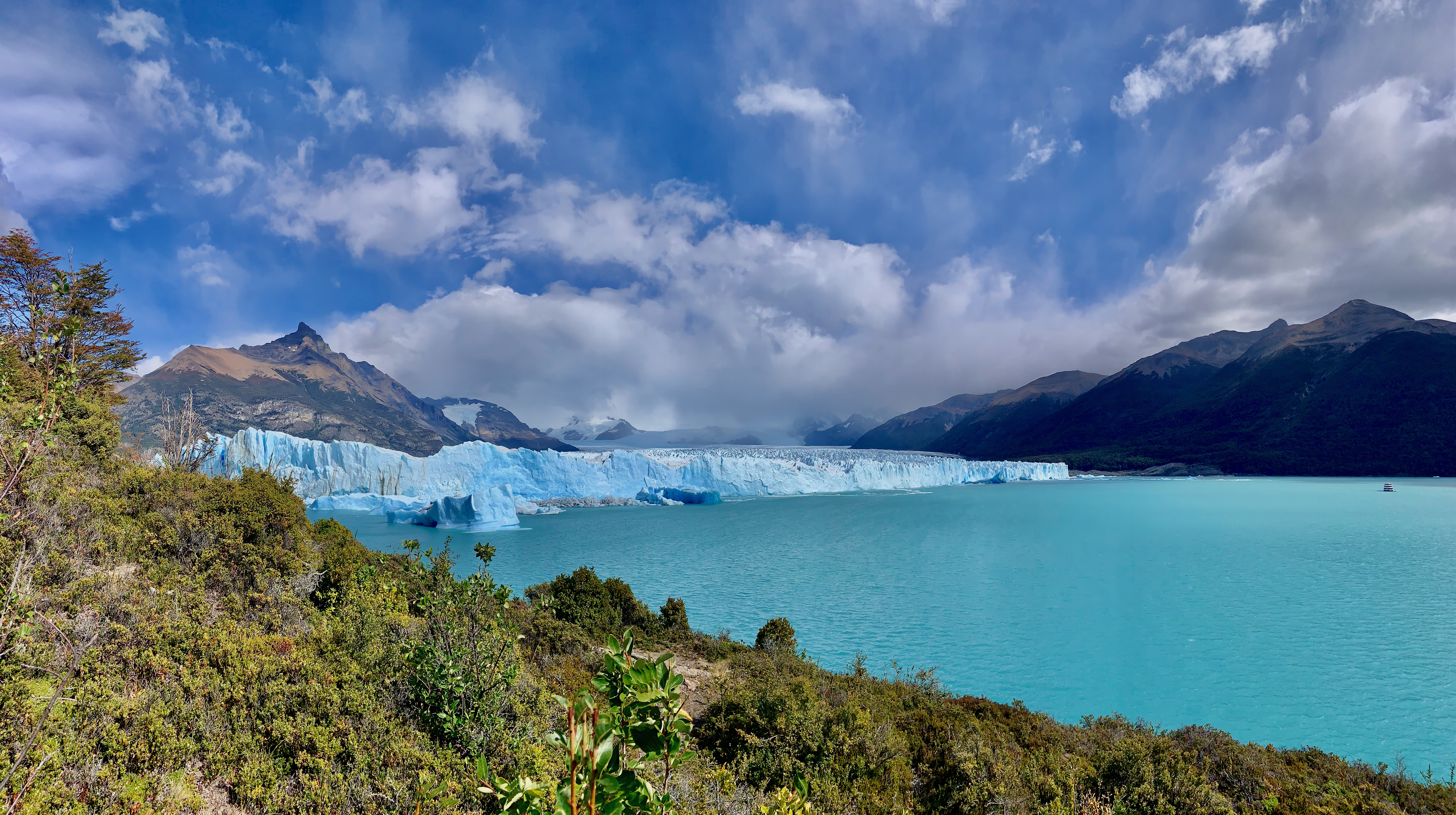 <figcaption>Perito Moreno Glacier.</figcaption>
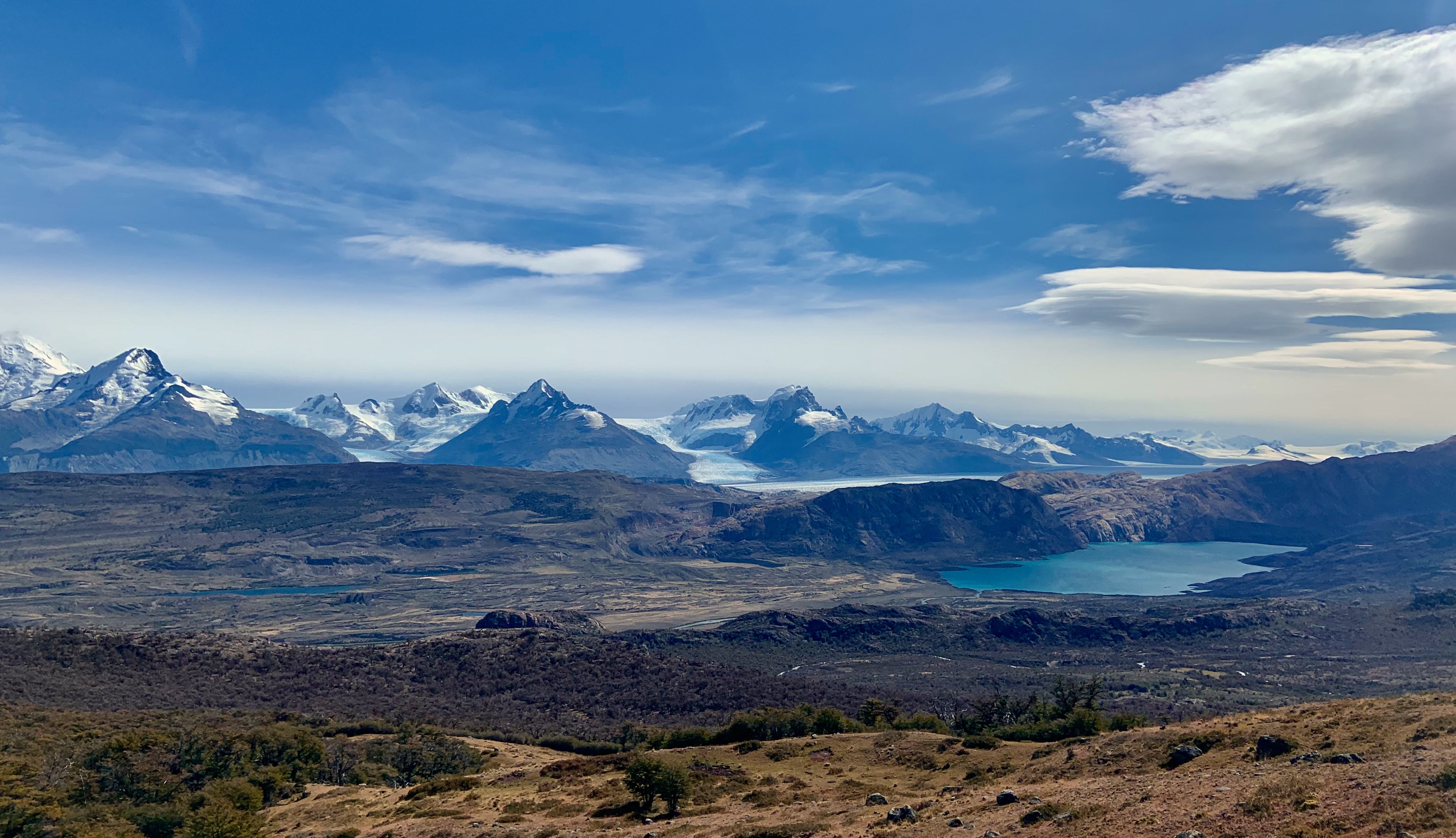 <figcaption>Glacial valley formed by the Upsala Glacier, Estancia Cristina.</figcaption>
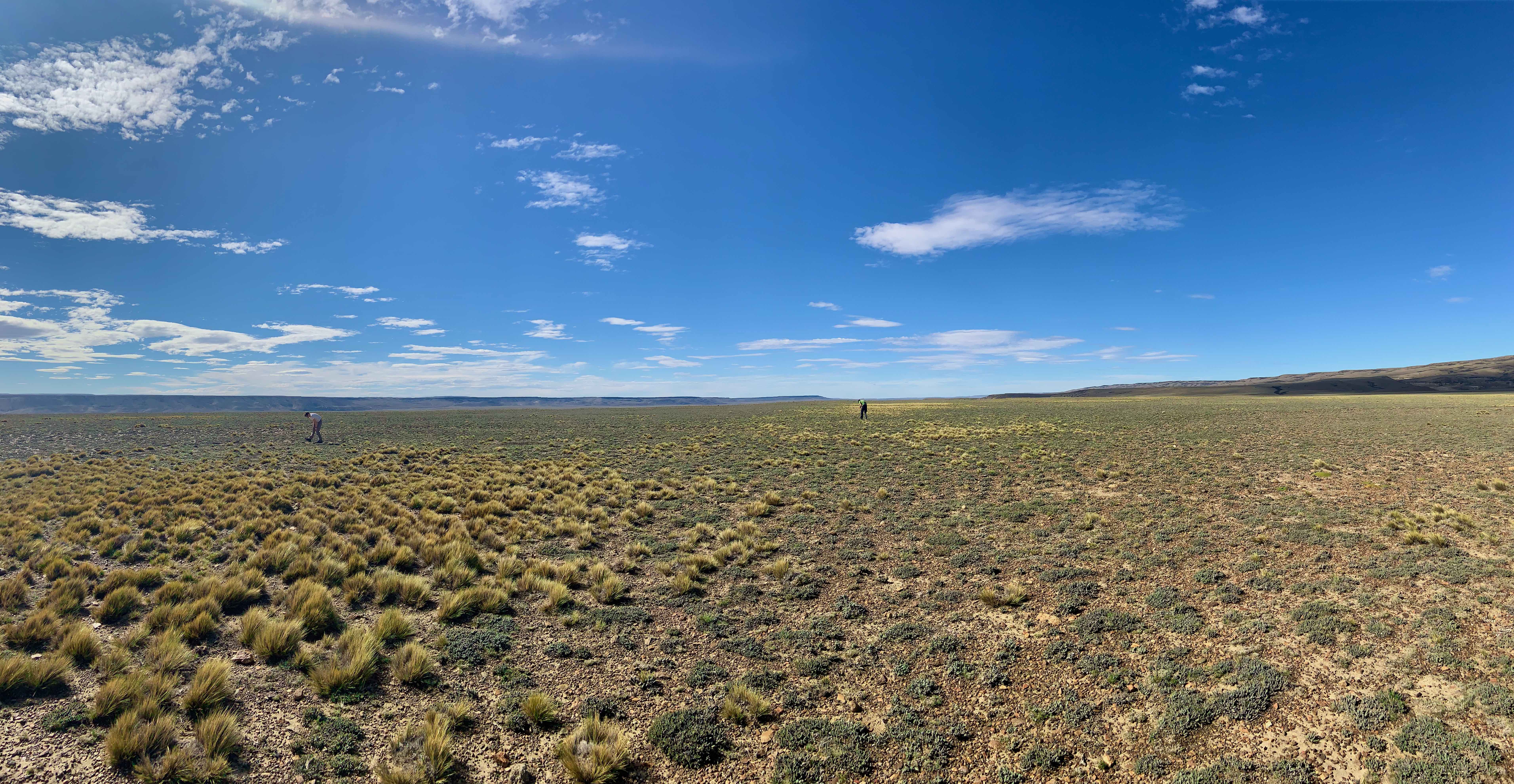 <figcaption>Sampling quartz cobbles from a fluvial terrace of the Rio Santa Cruz.</figcaption>
Cairngorms, Scotland
Can we predict river geochemistry?
August 2019
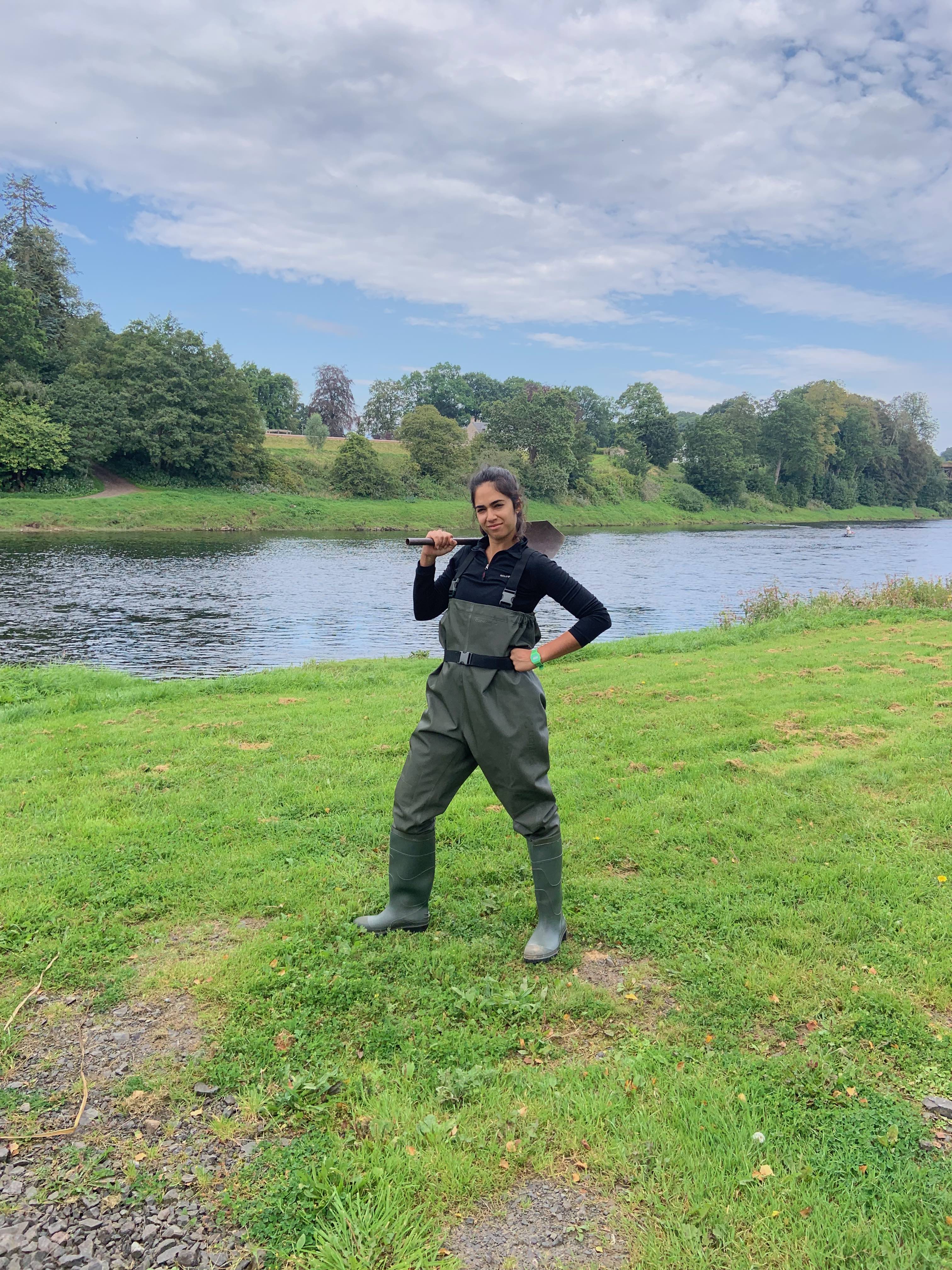
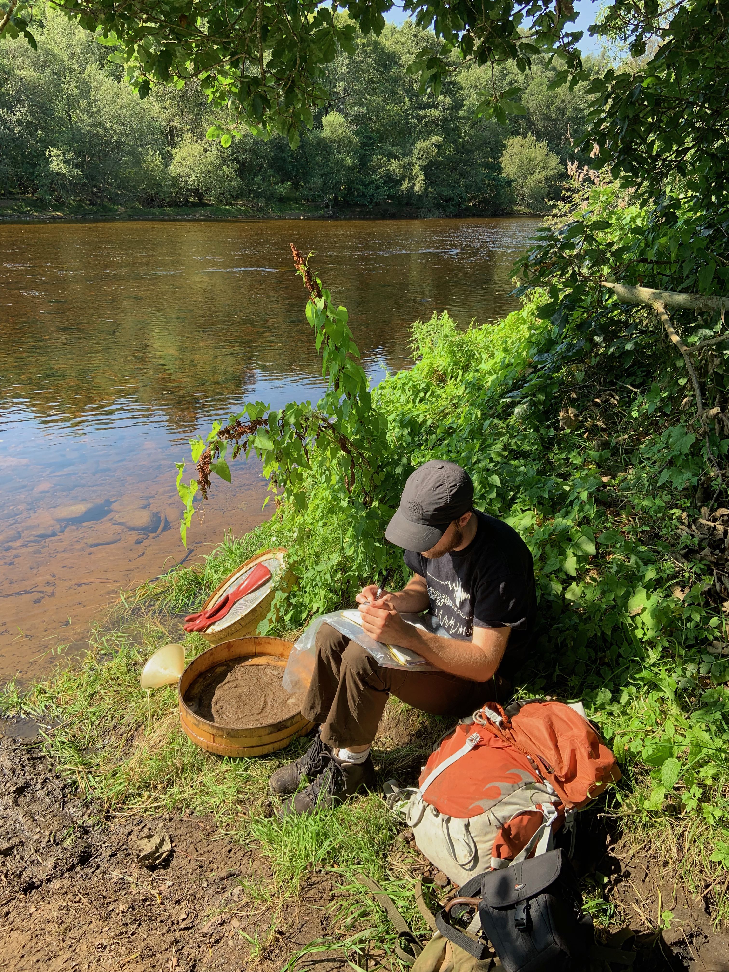
Together with Dr Alex Lipp, we set off for a week in Scotland to collect mud samples at key places along rivers draining the Cairngorms, with the aim of establishing the elemental composition of the transported material. We were incredibly lucky with the weather: no rain, warm summer temperatures, and the incredible absence of midges. Collecting sediments from the river bed often involved venturing into rivers in waders and shovelling sediments back to the river bank. There, we set up the sieving station: using a special set sieves we separated the fine from the coarse sediment fraction by rubbing the sediments through different meshes. The rubbing technique is not too dissimilar from the classic karate kid ‘wipe-on-wipe-off’ motion, which did lead us to build significant arm strength throughout the week. Much to Alex’s panic, we did occasionally encounter leeches in these sediments. We were often asked, usually by passing fishermen on their boats, whether we were looking for gold. This fieldtrip was somewhat different to the usual geology fieldwork, as we spent less time looking at rocks and more time appreciating the views. Overall, the trip as a success, with almost all collected sample yielding suitable geochemical measurements. You can read about the results here.
Calabria, Italy
Lithology, rock strength and the shapes of river profiles
June 2018
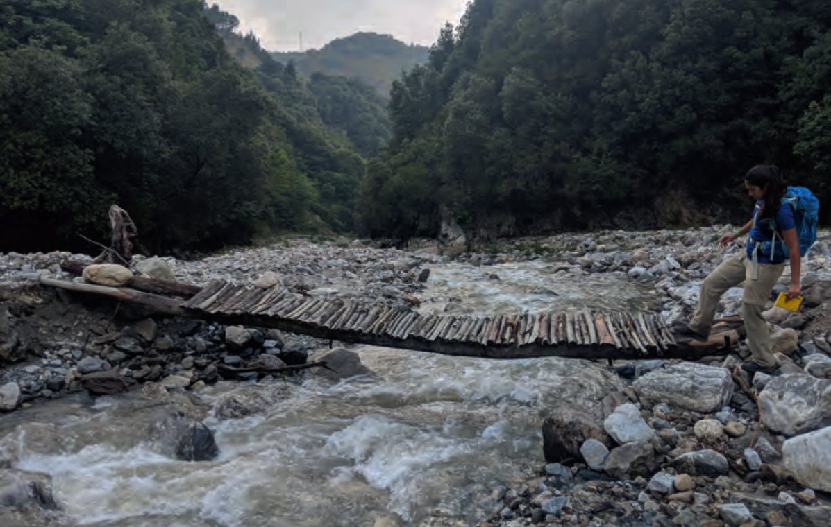
In the summer of 2018, Carla Pont asked me to join her in Calabria, Italy for some fieldwork. Excited with the prospect of a week by the coast in southern Italy, I packed my lightest field gear and flew to Reggio Calabia in the highest of spirits. The aim of the field trp was to investigate the role of bedrock lithology on the shapes of rivers in tectonically active areas. We focussed on three different rivers, all which flowed through varying lithologies as well as active faults. Our job was to collect rock strength and river width measurements at regular intervals along these rivers. Torrental rain throughout the week proved to be somewhat of a hurdle in collecting the measurements, and thoroughly dampened the mood. The region is prone to extreme flash-flood events, so the bottom of a remote river valley is not where you want to be when it starts to rain. Despite many of the access paths being washed away right before our eyes, we persevered and emerged victorious with extensive data in over 46 different localities. Carla has written a fantastic account of our excursion for Geoscientist magazine, which you can read here.
North Iceland
How fast are Iceland’s waterfalls retreating?
June 2017
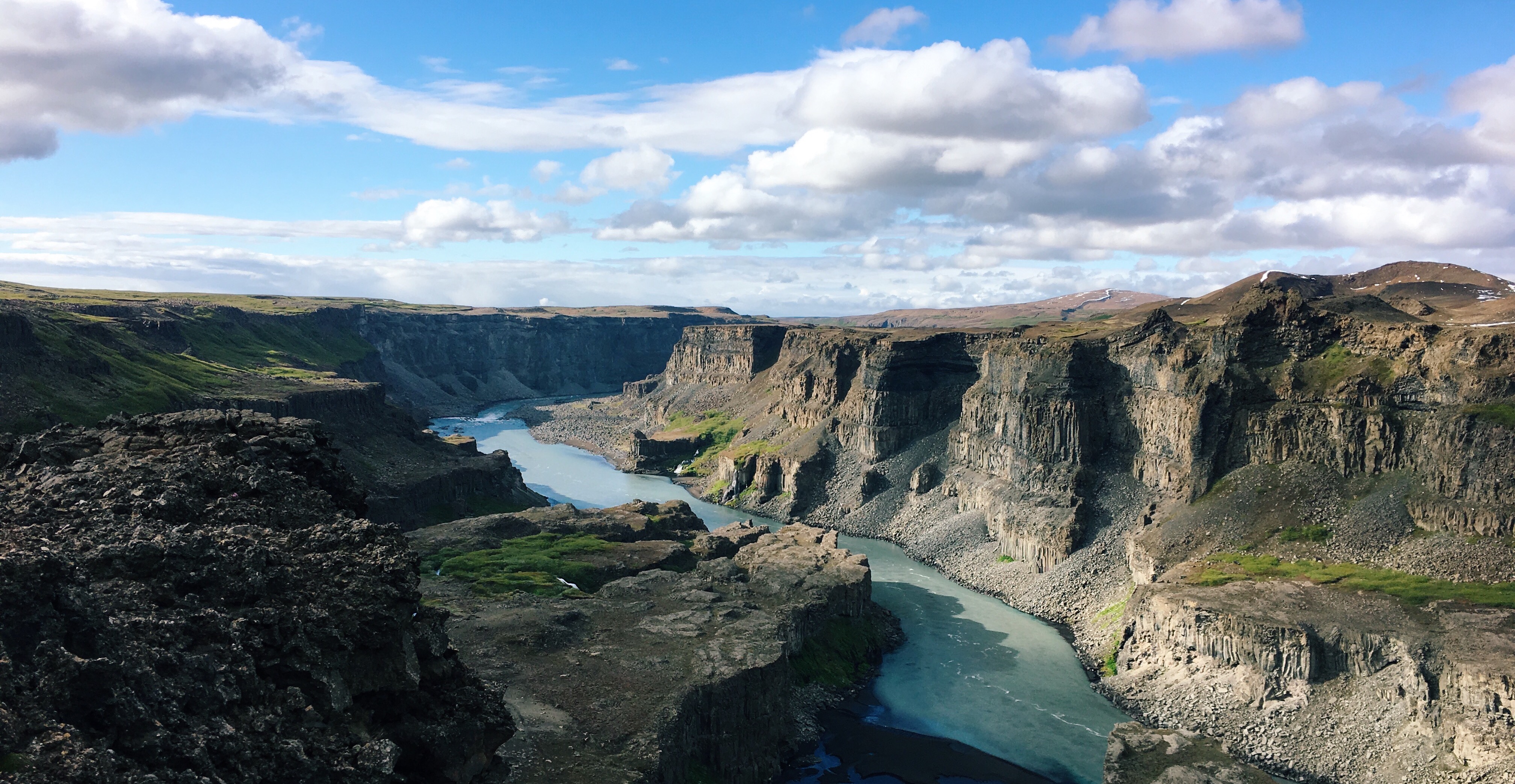
In June 2017, I joined Dr. Gaia Stucky de Quay for a field season in Iceland. We spent a total of 17 days in Iceland, with most of our time spent traversing the northeast of the island. The goal was to collect samples of exposed river terraces to obtain incision rates and waterfall retreat rates for rivers in Iceland. After a week-long reconnaissance of the island’s fluvial networks and waterfalls, we decided to focus on the Selfoss-Dettifoss-Hafragilsfoss waterfall system. These striking waterfalls are associated with three sets of well-defined abandoned fluvial terraces on either side of the canyon.
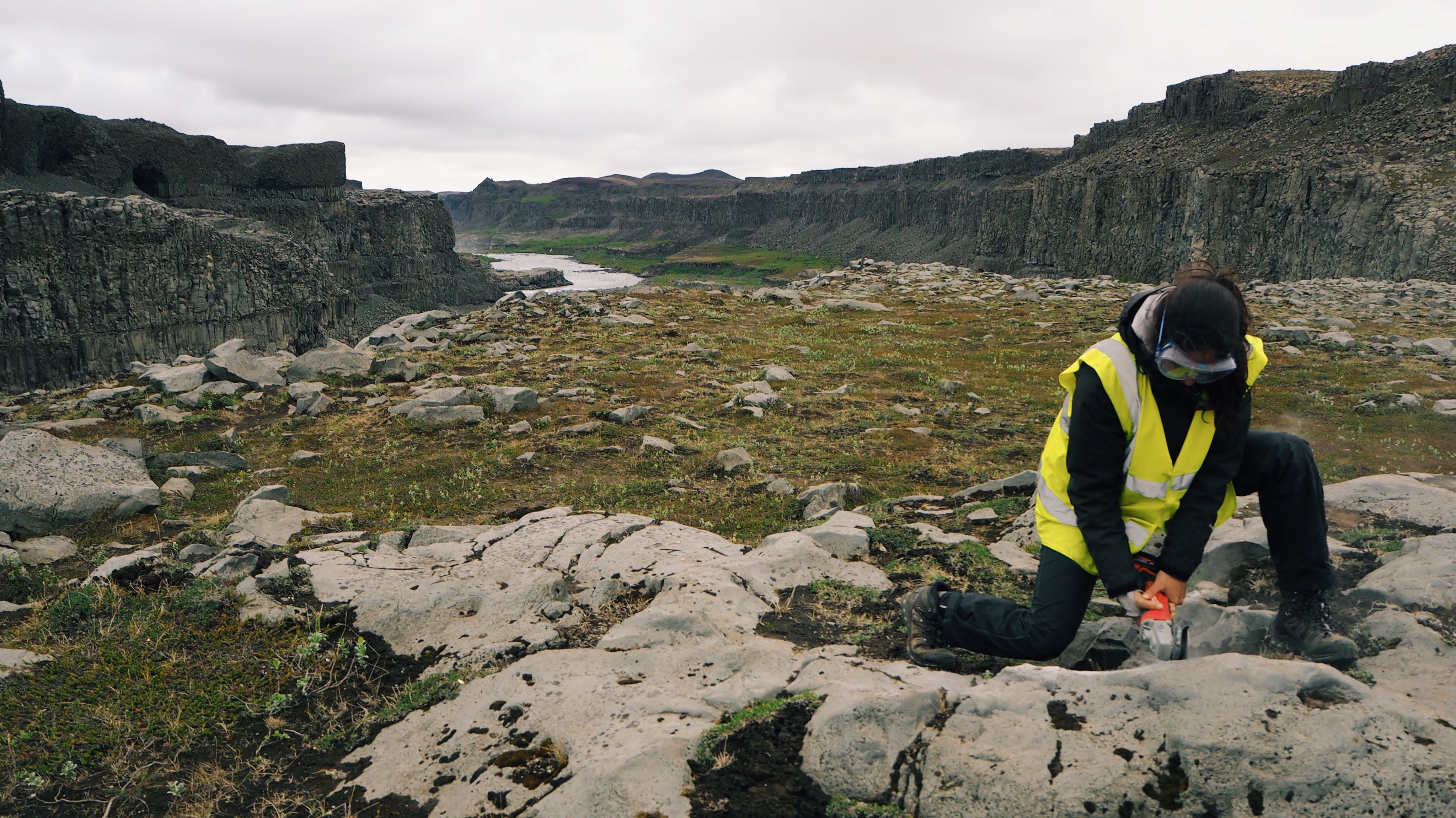
Using an angle grinder, hammer and chisel, we collected over 20 kg of basalt samples a day. We also conducted UAV photogrametry surveys of the canyon, coupled with high-resoulution GPS measurements, to generate a 3D model of the canyon. If you have visited this place you might know the are is a very popular tourist destination, so we attracted much attention with our drones, power tools and safety equipment. You can read the paper describing our data, methods and results here.
Serra da Capivara, Brazil
Mapping the geology at the edge of a cratonic basin
July–September 2014
Most geology degrees involve some form of geological mapping project, and I was fortunate enough to be able to carry out my fieldwork in my home country, Brazil. This was a unique opportunity for a non-Brazilian institution, as often brazilian bureaucracy tends to make life very hard for foreign researchers to access protected areas. Alongside my four field partners, I was based in São Raimundo Nonato, Piauí, for nine weeks. Our mapping area covered the southeast edge of the Serra da Capivara National Park, a well known site for hosting the oldest and largest collection of cave paintings in South America.
The extremely dry weather meant we did not see a single drop of rain, but everything we owned got covered in a thick layer of red dust. The goal was to map edge of the Parnaíba cratonic basin. The sedimentary basin units were Silurian-aged peri-glacial conglomerates and braided fluvial systems. Interesting to observe outcrops of channels without the characteristic overbank muds and paleosols. The basin-fill formed a striking escarpment, providing spectacular views of the endless plains of the brazilian outback, or ‘sertão’ as we call it. The basement rocks comprised Neoproterozoic greenschists and highly deformed microbially-generated carbonates. Our group produced the first 1:20 000 scale geological maps of the national park, and provided some new insights into the nature of the basin-basement contact of the Parnaíba Basin.